
Daytona Beach Neighbor Record Sources
A block lookup works best as a small evidence table. Start with the subject parcel, then add only the lots sharing its boundaries or lying within the clearly defined block. The parcel map supplies geography. Property cards supply assessed ownership. Deeds, voter extracts, city records, old directories, and civic pages each add a distinct layer. These sources can suggest which names have a documented link to the area, but they do not prove every current occupant.
| Block source | What it reveals nearby | How to access it |
|---|---|---|
| Parcel GIS and cards | Adjacent lots, owner, mailing and situs addresses, physical and tax facts | Free map and property search; ownership is not occupancy |
| Official Records | Deeds, liens, easements and parties for chosen parcels | Search owner or legal description; released web series from 1988 |
| Voter extract | Released residence fields sortable by geography when supplied | Formal public-record request; exemptions apply |
| iMS and code files | Projects, cases and public parties tied to an address | Public search or city request; no household roster |
| Reverse directory | Historical occupants and businesses by street number | Selected library and archive editions |
| Neighborhood organization | Public officers, contacts, meetings and events | City or organization pages; member lists are generally private |
The strongest result is modest: a documented set of parcels, assessed owners, public records, and public-facing community contacts. A mailing address elsewhere may signal a seasonal owner, company, agent, or second property. It does not identify the person living at the Daytona Beach situs address.
Map Daytona Beach Neighbors Precisely
Use the Volusia County Property Appraiser Map Search to locate the starting parcel. Zoom until parcel lines are distinct, turn on an aerial or useful context layer, and click every lot that shares a boundary. A numerically close house can sit across a road or beyond another tract. A rear or corner lot can be a true neighbor even when its street name differs.
- Search the full subject address or exact parcel number.
- Confirm the situs address and legal description on the property card.
- Zoom to block scale and mark every boundary-sharing parcel.
- Open each detail card and transcribe assessed owner, situs, mailing address, and parcel ID.
- Label vacant lots, common areas, commercial tracts, and multiunit parcels instead of forcing them into household rows.
- Use deeds or city files only for the selected parcels that need more context.
The map's parcel and boundary lines are representations, not a survey. Do not infer a legal boundary dispute from the screen. For a longer sequence covering an entire road, switch to the Daytona Beach street directory workflow; this method stays focused on the immediate block.
Block tip. GIS adjacency is more reliable than consecutive house numbers when identifying the Daytona Beach neighbors closest to one parcel.
Owners Are Not Always Neighbors
The Volusia Property Appraiser search accepts owner name, location address, and parcel number. Its cards can show parcel identifiers, assessed owner, mailing and situs addresses, legal description, municipality, subdivision or neighborhood, sales, values, exemptions, building facts, and map links. County information says current data update weekly.
These fields are valuable but limited. The assessed owner may be a company, trust, estate, seasonal owner, or person whose mail goes elsewhere. A homestead exemption can support owner occupancy under the applicable assessment conditions, yet it does not name a spouse, child, roommate, or other household member. Renters may not appear at all. Daytona Beach has tourist, condo, and seasonal ownership patterns that make “owner,” “mailing address,” and “resident” especially different.
| Card field | Safe reading |
|---|---|
| Situs address | The physical parcel location |
| Mailing address | Where owner correspondence is sent |
| Assessed owner | The owner shown on the assessment roll, not a household list |
| Homestead | Evidence related to owner occupancy, not every resident |
| Sales record | A lead to the Clerk's recorded instrument |
When presenting Daytona Beach neighbors, use “assessed owner” where that is all the card proves. Precise labels prevent a public ownership record from becoming a false claim about residence.
Daytona Beach Block Voter Data
The county's self-service voter tool is not a browse-by-street roll. It asks for the registered voter's first name, last name, and date of birth to return personal status, precinct, districts, polling, sample-ballot, and election information. Do not guess identity fields or treat it as a way to scan the block.
A geographic voter extract follows a different route. The Volusia Supervisor of Elections public-record page links order forms and the current price list. Requests may also be sent through the county public-record platform, by email to Elections@Volusia.org, by phone at 386-736-5930, or by mail or in person to the Supervisor at 1588 N. Woodland Boulevard in DeLand. The inspected forms allow the requester to specify a product, geography, party or status filters where offered, format, and delivery details.
Florida public voter fields can include name, residence and mailing address, date of birth, party, registration status, precinct and district, and election participation history. Participation means that the voter received or cast a ballot in an election, never the choices made on that secret ballot. Section 97.0585 protects social security and driver-license or state-ID numbers, registration source, preregistrant information, and signature copying. Address Confidentiality Program participants and other protected classes may also be shielded.
An inactive registration does not establish the exact day someone left. List maintenance involves notices, returned mail, and statutory procedures. Use the extract as one dated roll, not proof of a full current household.
Daytona Beach Civic Block Records
City records can explain what is happening around a block without identifying everyone who lives there. Daytona Beach iMS can surface address-based permit and license facts such as project type, work description, applicant or contractor, status, valuation, and inspection dates. Code files can contain an address, assessed owner, and public procedural events, though active investigative material or protected facts may be withheld. Named contractors and applicants are not presumed occupants.
The Daytona Beach agenda and document portal publishes commission and board materials. The assigned image shows the municipal record route used to locate meeting notices, agendas, and public documents tied to neighborhood issues.
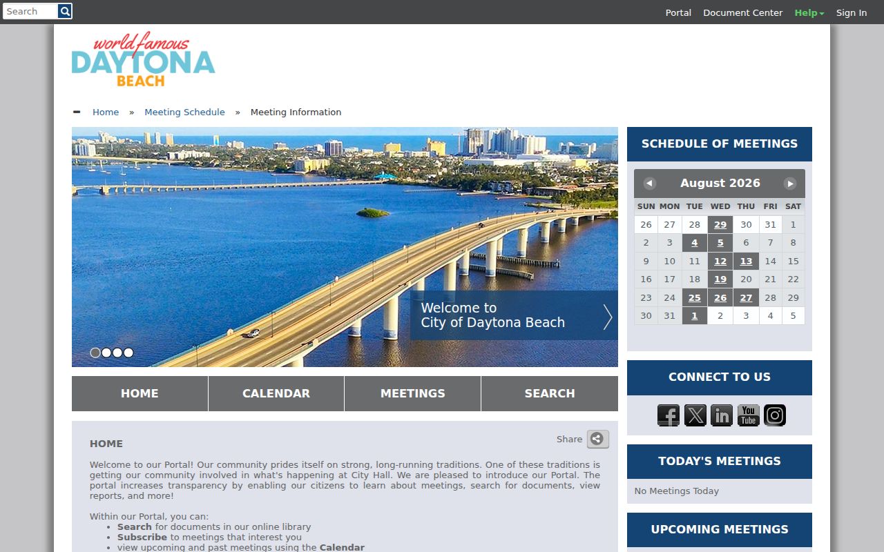
Search a street, project, redevelopment area, or board name. A resident who speaks publicly may appear in minutes, but a meeting record is a civic-participation record, not a resident roll.
The city department directory routes questions to GIS, Planning, Code Compliance, the City Clerk, and neighborhood services. Its public directory screen appears below.
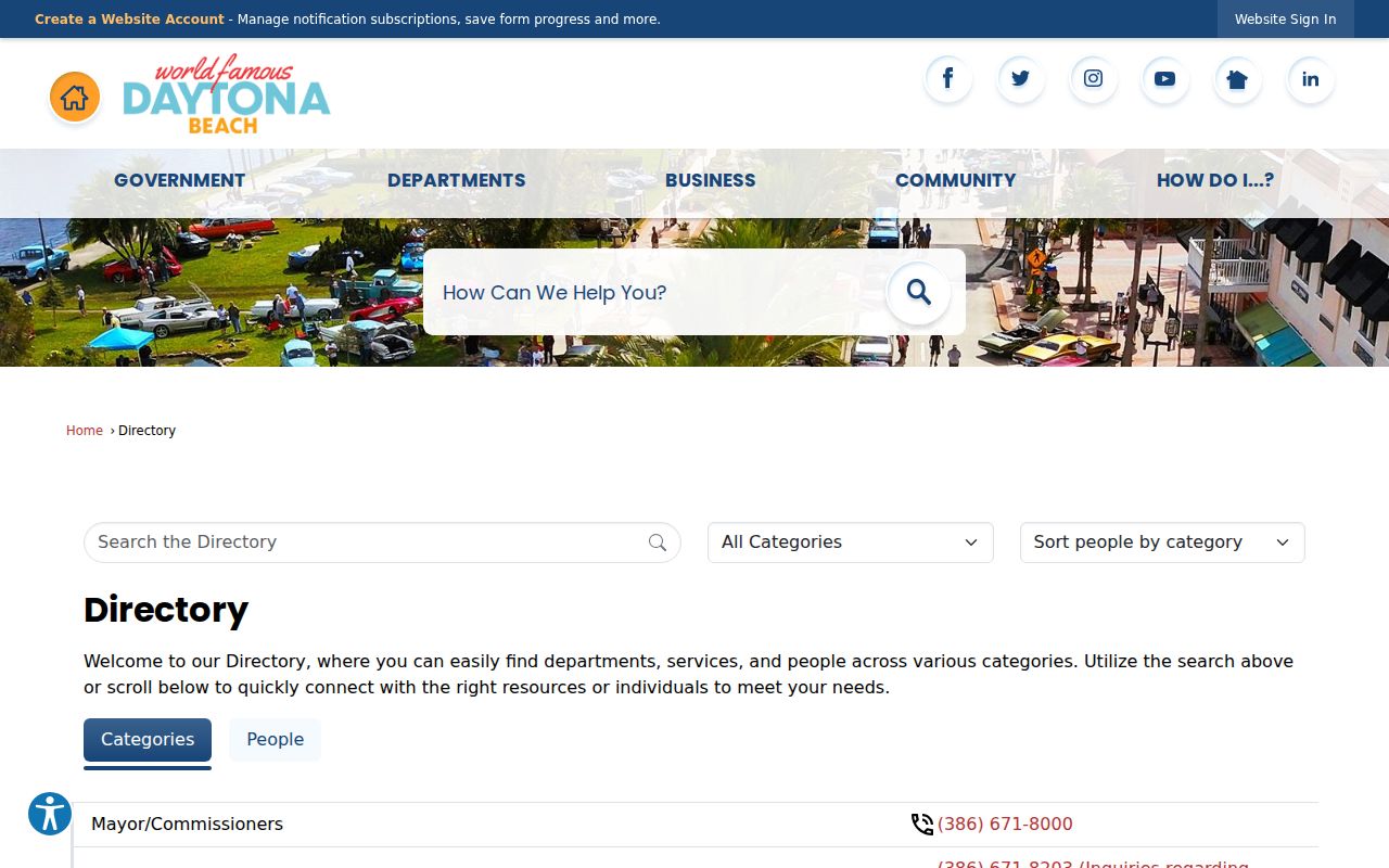
Use the department that owns the record. A focused request should state the address, date range, department, and record type. Florida law does not require an explanation of purpose.
Daytona Beach Neighborhood Gateways
Community geography includes Downtown, Main Street, Midtown, Ballough Road, and South Atlantic redevelopment areas, plus civic and homeowners groups within subdivisions. Redevelopment and Neighborhood Services is the city gateway. Public organization pages may identify officers, an official contact, meetings, and event participation. No verified citywide public membership directory was found, so private member lists should not be implied.
The Daytona Beach departments page connects residents to city functions, including the neighborhood-services route. The assigned capture below shows that gateway.
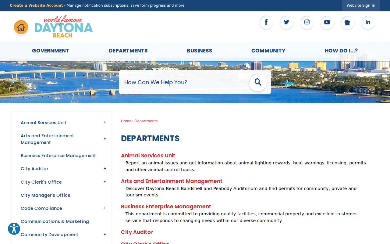
Ask for public board contacts, notices, or organization information. Do not ask a city employee to disclose a private HOA roster, congregation list, or neighborhood-watch participant list.
Redevelopment and Neighborhood Services
City gateway for redevelopment districts and neighborhood-service questions.
City Clerk
Municipal records custodian for focused requests by address, date, department, and record type.
Volusia Property Appraiser
Parcel map and assessed ownership records for the physical block.
Official Daytona Beach Neighbor Evidence
Commercial neighbor tools combine parcels, registrations, and proprietary files. Their output can retain old household associations or label an owner as a resident. Official records are narrower, but they disclose the custodian, date, field meaning, and route to a certified copy or correction.
| Question | Official-source approach | Commercial category risk |
|---|---|---|
| Which lots touch? | Parcel GIS with visible boundaries | Distance or street-order guesses |
| Who owns a lot? | Dated assessment card and deed | Stale ownership or merged identities |
| Who lives there? | No complete official household roll | Owner or old associate mislabeled as resident |
| Who represents a group? | Official organization contact or board page | Private member information without context |
Use official rolls for the fact each one is designed to establish. Where no public record answers the question, leave the cell blank. An unknown is more accurate than a commercial guess about your Daytona Beach neighbors.
The Volusia County online-services page brings the property search and other county services together. The official screen shown below helps confirm the custodian route rather than sending a block question to an unrelated office.
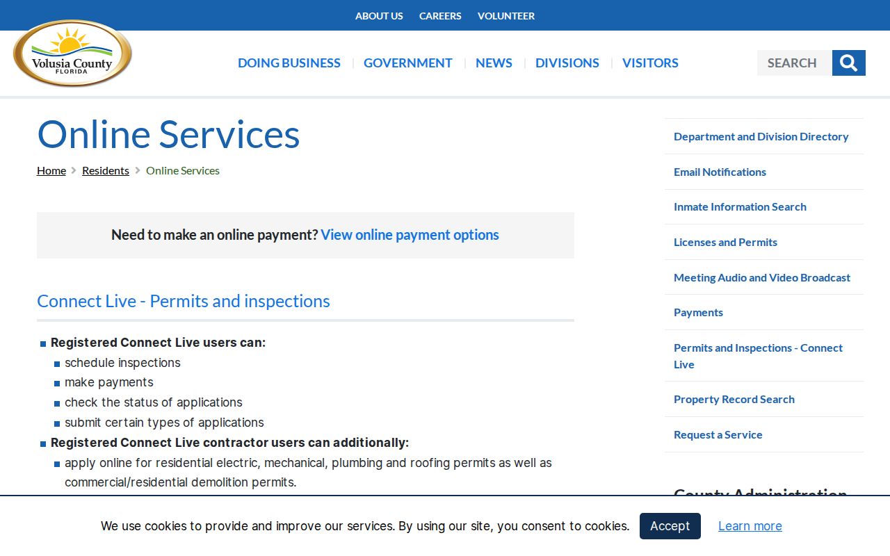
County pages are also the best place to check whether access methods or hours have changed.
Historical Daytona Beach Neighbors
A reverse city directory can rebuild an older block by street and house number. Record occupants and businesses exactly as printed, including vacant addresses and multiunit entries. Compare the prior and following volumes because publication omissions and moves can look alike. Known Daytona area directory editions run from 1914 through 1960 with gaps and later selected regional years.
The 1925 consolidation of Daytona, Daytona Beach, and Seabreeze may move the same household under a new heading. Search all three place names for early blocks. Sanborn maps can identify an old building footprint, street label, and use, while released federal census schedules add household relationships. A map never names a resident, and a directory market area does not prove the address was within municipal limits.
Historical neighbors belong to a dated reconstruction. Keep the year in every row so that names from different eras do not appear to share the block at once.
Privacy for Daytona Beach Neighbors
Private facts about renters, minors, household relationships, utility accounts, delivery data, and protected addresses do not belong in a block directory. Florida's Address Confidentiality Program gives qualifying survivors of domestic violence or stalking a substitute address for agency use. Separate Chapter 119 exemptions protect addresses for specified high-risk classes when the required process is followed.
Neighborhood-watch participation, congregation membership, and private HOA rosters should not be treated as public. The Florida Department of Corrections search is a specialized statewide source, not a routine block roster. Its official screen is shown only to make that boundary clear.
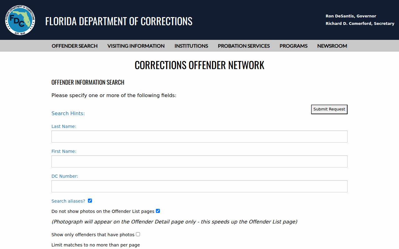
A lawful block search does not turn specialized public-safety records into a household directory, and a name result does not identify who occupies nearby homes.
Use Daytona Beach neighbor records for civic curiosity, property context, reconnecting, or personal safety awareness. Verify a name with its custodian and respect confidentiality flags.
Lawful use. Never use parcel, voter, or community data to watch, threaten, intimidate, or harass Daytona Beach neighbors.